Arkansas Goat Bluff Trail ~ 7.36 mile hike with 550' Sheer Cliffs and amazing views
I was supposed to go to Tennessee for a Motorcycle event but after those who had gone in the past were unable to go this year, I debated between flying solo (which would have been fine) or going somewhere else (still solo). I looked at a couple of maps for fun things to do and this picture, at midnight on Tuesday, secured my plan to go to Arkansas Wednesday morning bright and early (so I would get there in plenty of daylight, its only 11 hours).
Besides the photo, Goat Trail to Big Bluff hike immediately caught my attention with words like 'rugged hike', 'ledge trail', and 'not recommended if you dislike heights'. Big Bluff, as it is accurately named, is 550 feet tall and is the tallest sheer bluff face between the Rocky Mountains and Apalachian Mountains. I HAD to see this in person.
 Photo Courtesy of Aaron Bates from nps.gov (clearly a MUCH nicer camera than my old iphone)
I started early in the morning to beat the heat of the day with my backpack of goods and my GPS watch to track my steps (I was gonna blast my daily average out of the water real fast with this hike!). I can literally prove that vacation is healthier for me than work, if only someone would care enough to see my data and write me a note to never work again....anyways..


The hike starts at the top of the elevation pattern, and drops the equivalent height of the Golden Gate Bridge. Which means on the return trip, its basically all uphill. I was thankful for this by the end, odd as that sounds, because if I had hiked uphill the entire way out to the bluff, my legs would have been a bit too shaky for my liking as I maneuvered along the sheer rock ledge to get the best views I could get!!
Here starts the Goat Trail:


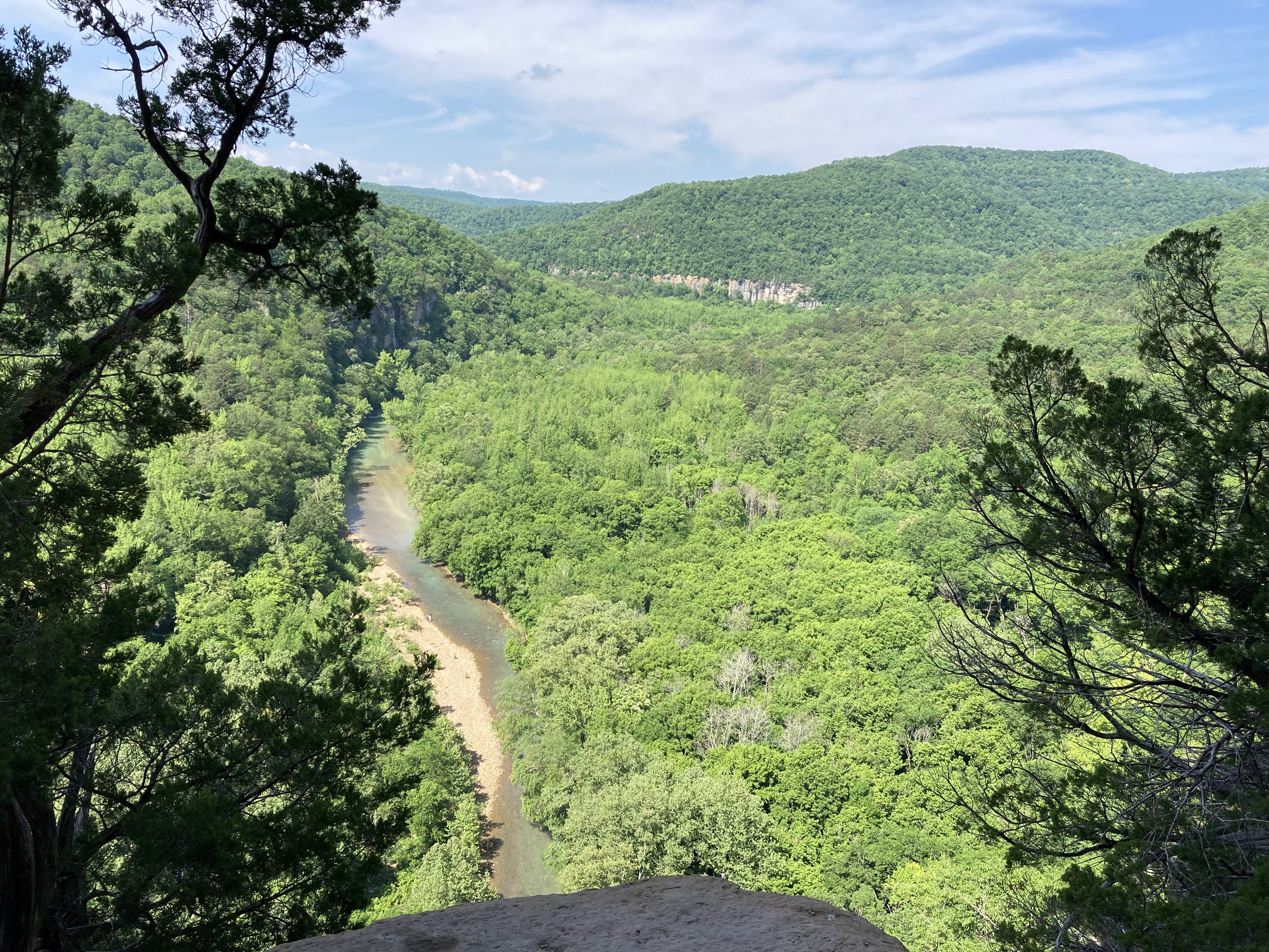
Getting closer to the Big Bluff, the trail narrowed and changed from gravel to rock and rock sand.


Then, just cliff rock


Complete with movements meant for doing the limbo...


And crawling through rock holes to get to the other side!


Nearing the end of the trail, the views started to appear. I was careful to STOP and look around me vs walk and look!! And then, the grand finale!!!! The pictures from my old iphone do NOT do justice to the beauty that was before me!


WARNING: The Centerpoint Trail/Big Bluff is one of the most frequent Search & Rescue (SAR) locations at Buffalo National River. Steep and strenuous trail conditions, coupled with a hiker's lack of preparation, can lead to dehydration, overexertion/exhaustion, and heat related illness. https://www.nps.gov/thingstodo/hike-to-big-bluff.htm
While I LOVE cliffs, I am not blind to the dangers that go along with hiking cliff trails (especially solo). I packed a gallon of water, a big bottle of Gatorade, some protein snacks, bug repellant, sunscreen, a few first aid type things, and even wore running shoes instead of my usual Ariat boots for the hike. I wasn't worried about falling off the cliff so much as I was worried about twisting an ankle in the middle of nowhere. I texted my plan and location to my parents, the bestie, and the boy. I was sure to have my SPOT device strapped on my belt loop, right next to my motorcycle key (way safer than in my pocket!). The SPOT is a GPS locater that can summon emergency help with the push of a button from anywhere, so long as I can see the sky. It sends the GPS coordinates to the nearest 911 center. Luckily, I didn't need that or the first aid items.
7.36 miles of adventure complete, just past noon. Not including stop and AWE time, it was just over 3 hours there and back. In total, it took roughly 4 hours. I took it easy on the mud covered rocky terrain and very easy on the cliff walls!


5/18/2023
Comments
Post a Comment